Cape York Camping Guide: Australia's Ultimate 4WD Adventure (2026)
Plan your Cape York 4WD camping trip in 2026 — 12 campgrounds, Old Telegraph Track, river crossings, QPWS permits, vehicle requirements, and a model guide for teardrop campers.
There is no road trip in Australia that separates the genuinely prepared from the optimistically under-equipped quite like Cape York. Australia’s northernmost point — Pajinka, “The Tip” — sits at latitude 10°41’S, some 1,000 kilometres north of Cairns. To reach it overland, you cross more than 20 rivers, grind through hundreds of kilometres of corrugated gravel, navigate the Old Telegraph Track’s infamous creek drops, and pass through some of the least-populated terrain on the continent. The reward is a landscape that 95 per cent of Australians will never see: ancient rainforests, floodplains thick with jabiru and brolga, spring-fed waterfalls that run croc-free, and a sign at the end of the track that says you have reached the top of Australia.
The Cape York Peninsula covers roughly 137,000 square kilometres — larger than the whole of England — yet has fewer than 20,000 permanent residents. In any given year, fewer than 50,000 vehicles make the journey to The Tip. It is not a casual road trip. But for campers who arrive with the right vehicle, the right rig, and a well-stocked trailer, it is arguably the greatest off-road camping experience this country offers.
This 2026 guide covers the 12 best campgrounds on Cape York, the Old Telegraph Track, river crossing conditions, QPWS permit fees, vehicle and camper requirements, and a model-matching table for Breath Trailer owners planning the journey.
Quick-Reference: 12 Best Cape York Camping Spots (2026)
| Campground | Location | Road | 2026 Fee | Self-Contain? | Highlights |
|---|---|---|---|---|---|
| Rinyirru (Lakefield) NP — Saltwater Crossing | ~400 km n. of Cairns | 4WD gravel | $7.75/adult | Strongly rec. | Crocs, brolga, jabiru wetlands |
| Laura / Ang-Gnarra NP | 330 km n. of Cairns | Sealed PDR | $7.75/adult | No | Quinkan Rock Art, Laura Races |
| Musgrave Roadhouse | ~490 km n. of Cairns | PDR gravel | ~$20/site | No | Fuel stop, cold beer, basic cabins |
| Archer River Roadhouse | ~530 km n. of Cairns | PDR gravel | ~$20/site | No | Last major washing facilities |
| Bramwell Junction Roadhouse | OTT entry point | 4WD gravel | ~$20/site | No | OTT staging point |
| Dulhunty River | OTT south section | 4WD rocky | $7.75/adult | Recommended | Croc-free swimming, shady flats |
| Fruit Bat Falls | OTT mid-section | 4WD | $7.75/adult | Recommended | Iconic croc-free swim spot |
| Sam Creek | OTT mid | 4WD rocky | $7.75/adult | Recommended | Hidden waterfall, peaceful camp |
| Elliot Falls / Twin Falls | OTT north / NPA | 4WD | $7.75/adult | Recommended | Multi-fall system, stunning pools |
| Heathlands (Jardine River NP) | North of Jardine ferry | 4WD | Incl. in ferry | Recommended | Pristine rivers, fishing, remote |
| Jardine River — south bank | Near Jardine crossing | 4WD | Incl. in ferry | Required | Remote, no facilities |
| Punsand Bay Private Camping | 5 km from The Tip | 4WD sandy track | ~$55–75/site | No | Beachfront bar, pizza, The Tip walk |
QPWS fee from 1 July 2026: $7.75 per adult per night, $31.00 per family per night. The Jardine River ferry ($150 return, cash or EFTPOS) includes your Northern Peninsula Area entry permit and covers Jardine River NP camping fees. Confirm current rates at parks.qld.gov.au.
When to Go: The Dry Season Window
Cape York is accessible only in the dry season, running from approximately late May to October. Outside this window, the wet season (November–April) turns rivers into uncrossable torrents, closes the Peninsula Development Road for weeks at a time, and renders the Old Telegraph Track completely impassable. The Cape receives up to 2,000 mm of rain annually, the vast majority falling between December and March.
| Month | Conditions | Verdict |
|---|---|---|
| May | Drying out, some greasy tracks | Possible — check road reports first |
| June | Clear skies, 28–30°C days, rivers predictable | Dry season opens — excellent |
| July | Peak season, school holidays, campgrounds at capacity | Excellent but busy — book months ahead |
| August | Slightly drier, PDR bulldust increasing | Excellent — book accommodation ahead |
| September | Heat rising, tracks powdery | Good but plan for high temperatures |
| October | Pre-wet humidity, early storm risk in afternoons | Last reasonable month |
| November–April | Wet season — Cape York effectively closed | Do not attempt |
Book Elliot Falls and Punsand Bay months in advance if travelling during July school holidays — they routinely reach capacity and Queensland Parks stops accepting bookings when sites are full.
Getting There: Distances and Road Conditions
Most travellers approach Cape York from Cairns via the Peninsula Development Road (PDR). A secondary approach is the Savannah Way from Mount Isa via Normanton and Cooktown — significantly longer but adds the Gulf Savannah region and suits those doing a full Big Lap circuit.
| Leg | Distance | Road Surface | Notes |
|---|---|---|---|
| Cairns → Mareeba | 65 km | Sealed | Reef-to-tablelands climb |
| Mareeba → Lakeland | 175 km | Sealed | Fuel at Lakeland — fill up |
| Lakeland → Laura | 68 km | Sealed / short gravel | Quinkan Rock Art detour here |
| Laura → Musgrave Roadhouse | 180 km | Gravel PDR | Corrugated — reduce tyre pressure |
| Musgrave → Archer River | 145 km | Gravel PDR | Section improving with new sealing |
| Archer River → Bamaga | ~350 km | Gravel PDR + OTT option | Critical remote section |
| Bamaga → The Tip (Pajinka) | 30 km | 4WD sandy track | High clearance essential |
| Total: Cairns → The Tip (PDR route) | ~1,000 km | Mixed | Allow 5–7 days minimum |
The longest gap between fuel stops is approximately 140 km; however, availability and diesel quality at remote roadhouses can vary. Carry a minimum of 20 extra litres of fuel per vehicle when deviating from the PDR, and 40+ litres for any Old Telegraph Track sections. Expect fuel to cost 60–90 cents per litre more than Cairns prices. In Bamaga, budget $2.80–$3.20 per litre in 2026.
Peninsula Development Road: The Highway North
The PDR stretches from Lakeland (north of Cairns) all the way to Bamaga on the tip of the peninsula. The Queensland Government is progressively sealing it, but significant sections — particularly between the Archer River and Wenlock River — remain corrugated gravel in 2026. Early-season reports from June 2026 indicate the worst washouts from the mild 2025–26 wet season have been cleared.
Practical tips for the PDR:
- Reduce tyre pressure to 28–32 PSI on gravel sections; re-inflate before rejoining sealed road
- Cruise at 80–90 km/h on corrugations rather than powering through at 100+ km/h — it extends your tyre and suspension life dramatically
- Check Cook Shire Council road conditions and the NPARC roads report before departing Cairns
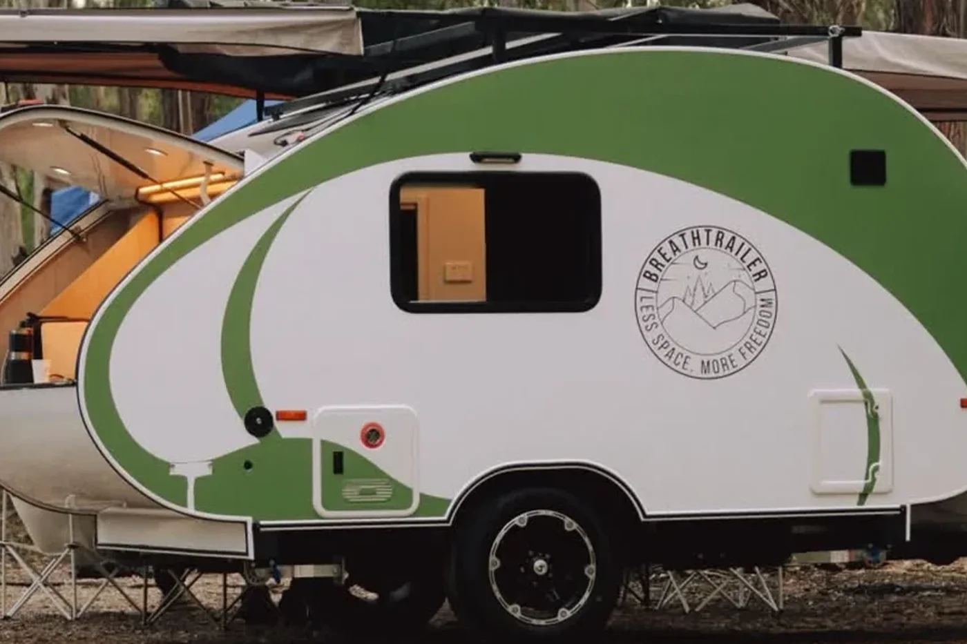
A hard-shell teardrop camper handles PDR corrugations significantly better than a canvas-walled camper. There is no canvas to delaminate, no pole sleeves to split, and no zip to blow out at sustained high frequency. The rigid shell transmits vibration into the chassis rather than the walls. Your suspension setup matters more on Cape York than almost any other Australian destination — independent coil suspension with at least 150 mm of wheel travel is worth every dollar on this road.
Old Telegraph Track: Australia’s Most Famous 4WD Challenge
The Old Telegraph Track (OTT) is the original route used to service the overland telegraph line that connected Darwin to Cooktown in the 1880s. Today it is a legendary 4WD track running alongside — and frequently crossing — the PDR between Bramwell Junction and the Jardine River, roughly 600 km in length.
Most travellers pick and choose sections of the OTT rather than committing to the entire track. The notorious creek drops are concentrated between Gunshot Creek and the Jardine River — approximately 200 km of the most demanding 4WD terrain in Australia.
The Major Obstacles
Gunshot Creek is the most photographed challenge on Cape York. The main line entry is near-vertical — approximately 2.5 metres — into the creek bed. Most vehicles take the bypass. Committed 4WDers with snorkels, high-lift jacks, and a healthy disregard for their diffs take the direct line. It is not for first-timers.
Mistake Creek looks deceptively shallow on entry but has a soft, sandy bottom that swallows vehicles confidently driven by drivers who did not walk it first. The exit is steep and loose.
Cypress Creek features a log bridge rebuilt each dry season by travellers using found timber and ratchet straps — narrow, creaky, and one of the most authentically outback moments on the entire track.
Logans Creek is the final major crossing before the Jardine River ferry and is manageable in correct conditions, but always walk it first regardless of how confident the approach looks.
Towing advice for the OTT: run the established bypass routes around the major creek drops. A trailer adds significant length to your entry angle and complicates recovery when you go wrong — and on Cape York, going wrong at a creek crossing is expensive and very slow. The scenery on the bypass alternatives is equally spectacular, and you arrive at camp in the evening rather than at midnight with a bent drawbar. The PDR route to The Tip is fully achievable with an off-road-rated teardrop trailer.
Cape York’s Best Campgrounds in Detail
Rinyirru (Lakefield) National Park
Queensland’s second-largest national park covers 537,000 hectares of floodplains, river systems, and eucalypt woodland. The Saltwater Crossing camping area on the North Kennedy River is the park’s signature site — large saltwater crocodiles are frequently observed from camp, jabiru stalk the shallows at dawn, and the brolga count at dusk is genuinely spectacular. This is wildlife tourism at its most unfiltered.
Booking is mandatory through parks.qld.gov.au well in advance. There is no mobile coverage on site. Total self-sufficiency is required — no fuel, food, or first aid within the park. Keep your camp at least 50 metres from any body of water at all times; this is a QPWS regulation in crocodile habitat, not a suggestion.
Road rating: 4WD gravel ⚠️ | Self-containment strongly recommended | Best for: wildlife photography, remote immersion
Archer River Roadhouse
Not a national park, but arguably the most important stop on the PDR north of Cairns. Archer River is the last point with reliable washing machines, a working kitchen, cold fuel, and a bar before conditions become genuinely remote. Powered and unpowered sites are available at the roadhouse’s campground.
Many experienced travellers use Archer River as a “shake down” camp after the long PDR corrugated section — an opportunity to check wheel bearing temperature, re-torque the coupling, and inspect the trailer for any fatigue damage before the harder section ahead.
Fruit Bat Falls
The waterfall that fills half the Cape York social media feeds. A short detour off the OTT, Fruit Bat Falls runs over sandstone ledges into a wide, clear pool. Spring-fed, the water stays cold even in late-season heat, and the falls are considered croc-free — a rare luxury on the Cape. QPWS camping at $7.75/adult within walking distance of the falls. Books out weeks ahead in peak season.
Sam Creek
Sam Creek is the insider recommendation from everyone who asks locals rather than tourist brochures. Peaceful, well-shaded, with a hidden swimming hole and a small waterfall a short walk from camp. Quieter than Fruit Bat Falls even in peak season, and with a genuinely remote feel despite being accessible to vehicles towing a trailer.
Punsand Bay Private Camping
Punsand Bay sits 5 km south-west of Pajinka (The Tip) and is the base camp for the majority of travellers making the final push to Australia’s northernmost point. Privately operated, with powered and unpowered sites from approximately $55–75 per night. The drawcards: an open-air bar with cold beer, wood-fired pizza, and an unobstructed ocean view across the Coral Sea toward Papua New Guinea’s coastline — visible on clear mornings.
Walk to Pajinka at dawn. The monument marks The Tip. Standing at the northernmost point of Australia as the sun rises over the Torres Strait is worth every corrugation that got you there.
Waterfalls and Swimming Holes
After hundreds of kilometres of bulldust and corrugations, dropping into a spring-fed pool beneath a sandstone falls is the reset button every Cape York trip requires.
| Falls | Location | Croc Risk | Notes |
|---|---|---|---|
| Fruit Bat Falls | OTT, 20 km south of Jardine | Generally croc-free | Best access; crowded in peak season |
| Eliot Falls (Upper) | Near Twin Falls | Generally croc-free | Deep pools, multiple tiers |
| Twin Falls | 3 km from Eliot Falls | Generally croc-free | Spectacular cascade, less crowded |
| Jardine River (crossing) | Jardine ferry area | Crocodiles present | Observation only — no swimming |
| Archer River | Near roadhouse | Crocodiles present | Observe from bank only |
“Generally croc-free” reflects local knowledge and typical conditions, not a guarantee. Crocodile movement is unpredictable. Check current QPWS signage at each falls on arrival — rangers update signs when animals are sighted, and signage overrides all other advice.
River Crossings: What to Expect
| Crossing | Difficulty (dry season) | Typical Depth | Notes for Trailers |
|---|---|---|---|
| Gunshot Creek | Extreme | Near-vertical entry | Take bypass — direct line not suitable for trailers |
| Mistake Creek | Hard | 0.5–0.8 m | Soft sand exit; walk first; deceptive |
| Cypress Creek | Moderate | 0.3–0.5 m | Log bridge — passable for light trailers |
| Logans Creek | Moderate | 0.5–1.0 m | Walk it first; sand exit can trap trailers |
| Archer River | Moderate–Hard | 0.3–0.8 m | Funnels flow at causeway; high risk in early season |
| Jardine River | Vehicle ferry only | N/A | Ferry mandatory — $150 return, no vehicle crossing |
For any river crossing while towing: disconnect and pull the trailer separately if in doubt about the exit gradient. A confident water entry with a trailer that gets stuck on the exit costs you hours and potentially a winch recovery. See our towing tips guide for reversing technique and coupling disconnection procedure before you leave.
Permits, Fees, and Regulations
| Area | Permit Required? | 2026 Cost | How to Book |
|---|---|---|---|
| QPWS national parks (most areas) | Yes — pre-book | $7.75/adult/night | parks.qld.gov.au |
| Jardine River NP + NPA access | Yes (via ferry ticket) | $150 return (ferry incl.) | On-site or pre-purchase |
| CYPAL-managed Aboriginal land | Yes (incl. in NP permit) | See NP rates | parks.qld.gov.au |
| Roadhouse campgrounds | No | ~$20–75/site | On arrival |
| Quinkan Rock Art (Laura) | No (entry free) | Guided tours from ~$45 | Ang-Gnarra Aboriginal Corp |
Much of northern Cape York sits within Cape York Peninsula Aboriginal Land (CYPAL), managed jointly by Traditional Owners and the Queensland government. Camping in CYPAL-managed national parks requires pre-booking through parks.qld.gov.au. Strictly no alcohol in many northern communities — penalties apply.
Vehicle and Camper Requirements
Cape York is the most demanding overland route in Australia. Gear choices adequate for Fraser Island or even the Gibb River Road may fall short here.
| Requirement | Why It Matters on Cape York |
|---|---|
| High-clearance 4WD with low-range | Essential for OTT bypasses and the final track to Pajinka |
| Snorkel (raised air intake) | Strongly recommended for any creek crossing deeper than 0.4 m |
| All-terrain or LT-rated tyres | PDR corrugations destroy standard highway tyres within 200 km |
| Dual battery + DC-DC charger | Extended camping without mains access north of Archer River |
| Recovery kit (MaxTrax, snatch strap, hi-lift jack) | Sand exits, creek banks, and soft ground require recovery capability |
| On-board compressor | Reduce tyre pressure on gravel, reinflate before sealed road — daily |
| Spare parts (fan belt, filters, fuses, spare tyre × 2) | Nearest mechanic can be 300+ km south |
| Satellite communicator (PLB or Garmin inReach) | Mobile coverage ends effectively north of Mossman |
For your camper trailer, off-road rated suspension is essential — independent coil rather than leaf spring. Tow ball weight management matters on corrugated roads; an overloaded ball weight accelerates both sway and fatigue cracking in the drawbar. A hard-shell teardrop’s lower tare weight means less mass transferring through the hitch on each corrugation cycle versus a canvas trailer loaded with equivalent gear. See the full off-road accessories checklist for what to pack.
Self-Containment and Free Camping on Cape York
Self-containment on Cape York is not just an administrative checkbox — it is a practical necessity. Between the Jardine River and The Tip, there are no dump points, no mains water, and no amenities blocks. CYPAL land and Jardine River NP have zero-discharge requirements for grey water. Rangers can and do issue on-the-spot infringement notices.
For a couple spending 10+ days north of the Archer River, self-containment delivers:
- Freedom to camp at designated sites without amenities blocks (most northern sites have none)
- Grey water contained in sensitive river catchments — a legal and ethical requirement
- Flexibility to stay at low-use sites away from the main campground crowds
The self-containment regulations vary by land type. As a general rule above the Archer River: assume self-containment is required at any site more than 5 km off the PDR.
Knowing how long your water, power, food and grey water systems last before you leave is not optional on Cape York — resupply points north of Bamaga do not exist. A couple with an 80-litre water tank, 120 Ah lithium battery, and a composting toilet can realistically plan for 5–7 nights off-grid between refills.
Which Breath Trailer Model for Cape York?
| Model | Tare | Bathroom | Off-Road Capability | Cape York Verdict |
|---|---|---|---|---|
| Essential $23,320 | 700 kg | External connection only | Leaf spring (upgrade available) | PDR capable; avoid OTT with trailer; limited free-camping north of Jardine |
| Plus $29,766 | 800 kg | External shower point | Leaf spring (upgrade available) | PDR to The Tip; consider suspension upgrade; plan around serviced sites |
| Ultra $34,749 | 900 kg | External shower | Independent coil available | PDR + OTT bypasses; ideal for 2-week PDR trips; external shower suits |
| Max $47,190 | 1,200 kg | Full interior bathroom (toilet + shower) | Independent coil standard | Self-contained Cape York rig — free camping north of Jardine with no facility dependency |
The Max is the natural Cape York answer, but honest nuance applies: the Essential and Plus are capable of reaching The Tip via the PDR. What they cannot provide is the self-contained freedom to camp for multiple nights north of the Jardine River without serviced sites. If your itinerary includes 3+ nights north of the ferry at remote QPWS or CYPAL camping areas, the Max removes the single biggest practical constraint of the trip.
Browse the model comparison or book a viewing appointment to discuss which setup suits your specific route and timing.
Cape York Camping FAQ
When does Cape York open each year? The Cape is typically accessible from late May, once the Peninsula Development Road dries out and major river levels drop to safe crossing depths. June is the first reliably good month; July–August is peak season. The exact opening date varies by wet season severity — check Cook Shire Council and NPARC road condition reports before committing to dates.
Do I need a permit to drive to Cape York? The PDR itself is a public road requiring no permit. Permits are required for camping in QPWS national parks ($7.75/adult/night, booked at parks.qld.gov.au). The Jardine River Ferry fee ($150 return) includes your Northern Peninsula Area access permit and covers camping fees within Jardine River NP.
Can I tow a camper trailer on the Old Telegraph Track? Yes, on the established bypass routes around the major creek drops (Gunshot, Mistake Creek, Logans Creek). A trailer should not attempt the direct OTT creek descents — the entry angle and recovery complexity make it impractical without a second vehicle and professional recovery equipment. The PDR route all the way to The Tip is accessible for any off-road-rated teardrop trailer.
Is a teardrop camper a good choice for Cape York? Yes — a hard-shell teardrop’s advantages on Cape York are real: lower tare weight (less stress on tow vehicle cooling and brakes on long corrugated days), no canvas to mould, split, or zip-fail under sustained vibration, a smaller footprint at narrow campsites on the OTT, and 5-minute setup when you arrive exhausted after 10 hours on gravel. The key question is bathroom — above the Jardine River, the self-contained Breath Max changes the trip significantly.
What mobile coverage should I expect? Telstra 4G coverage ends effectively north of Mossman. From Laura northward, assume zero mobile coverage. A satellite communicator — PLB for emergencies plus Garmin inReach Mini 2 ($599) or ZOLEO ($449) for two-way messaging — is non-negotiable. See our off-road accessories guide for specific models and current pricing.
How much fuel should I carry? The longest gap between fuel bowsers on the PDR is approximately 140 km. Carry a minimum of 20 extra litres when staying on the PDR; 40+ litres for any OTT sections or remote detours. Fill at every opportunity north of Cairns regardless of gauge — roadhouses can sell out during peak season.
Recommended Reading
- Best Camping Spots in Queensland: Coast, Rainforest & Outback (2026) — 18 campgrounds across the full state, with QPWS fees and road ratings
- Best Teardrop Camper Destinations by State Australia — all 8 states and territories in one guide
- Off-Road Teardrop Camper Australia Guide — suspension ratings, ground clearance, and what “off-road capable” actually means
- How Long Can You Stay Off Grid Camping? — water, power, food, and grey water maths for remote trips
- Must-Have Accessories for Off-Road Adventures Australia — recovery gear, comms, tyre management, and priority order by budget